Services Service Areas About Blog Get a Quote

Aerial Property Mapping.
Eliminate the Guesswork.

Top-down aerial views and mapped imagery for accurate planning, estimating, and site documentation — built for contractors, developers, and property managers who need to know exactly what they're working with before they commit.

FAA Part 107 CertifiedLicensed commercial drone operator
Fully InsuredCommercial liability coverage
24-Hour TurnaroundReports delivered same or next day
Multi-Acre CapableLarge sites & commercial properties
What's Included

See the Whole Site
Before You Bid

Accurate aerial reference imagery that removes surprises from estimating, planning, and ongoing site management.

Top-Down Aerial Views

Full-site overhead imagery showing lot boundaries, structures, drainage paths, and access points at a glance.

Accurate Planning Reference

Give estimators and project managers a clear visual baseline before a crew ever sets foot on site.

Ongoing Site Documentation

Track site changes over time with repeat flights — useful for multi-phase projects and long-term accounts.

Bid-Ready Imagery

Clean, exportable imagery you can drop straight into a proposal or estimate document.

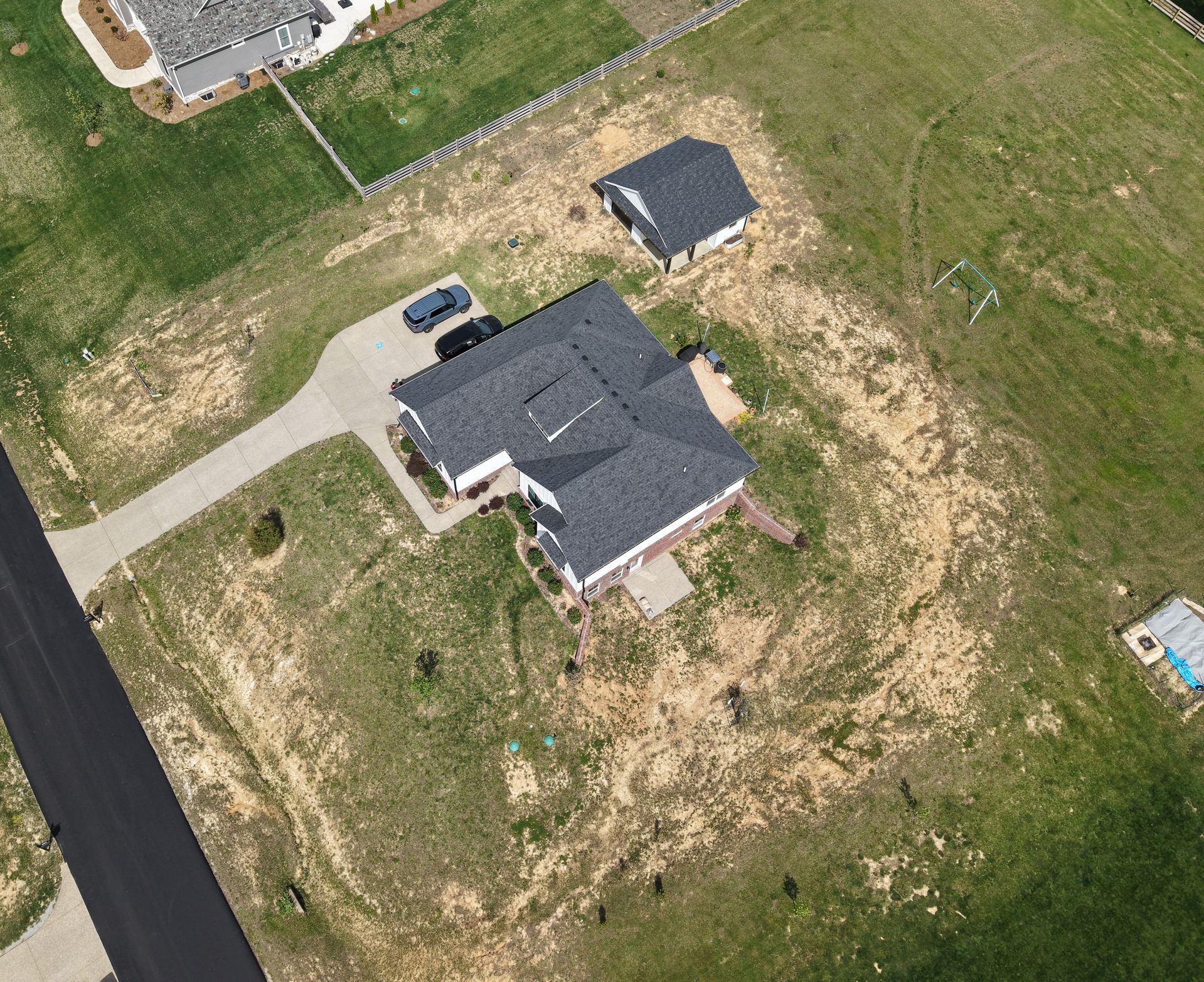
Aerial view of a Louisville-area property showing the roof, driveway, detached garage, and surrounding land
Who This Is For

Built for Bigger Jobs and Bigger Sites

Roofing and construction contractors use property mapping to scope multi-structure jobs accurately before quoting. Property managers use it to keep a visual record of large or multi-building portfolios. Developers use it to evaluate land before committing.

If ground-level photos and guesswork are costing you accuracy on bids, aerial mapping gives you the full picture in a single flight.

Get a Site Mapped →
FAQ

Common Questions

What is aerial property mapping used for?

It gives contractors, estimators, and property managers an accurate top-down view of a site — lot boundaries, structures, drainage, and access points — used for bids, planning, and ongoing site documentation.

Is this the same as a legal land survey?

No. Aerial mapping gives you accurate visual and measurement reference for planning and estimating purposes; it isn't a substitute for a licensed surveyor's legal boundary survey.

Can you map large or multi-acre properties?

Yes. Multi-acre sites, commercial properties, and multi-property contractor accounts are common — ask about custom and volume pricing on our pricing page.

Get an Accurate Read on Your Site

Most flights are scheduled within 24–48 hours of booking.